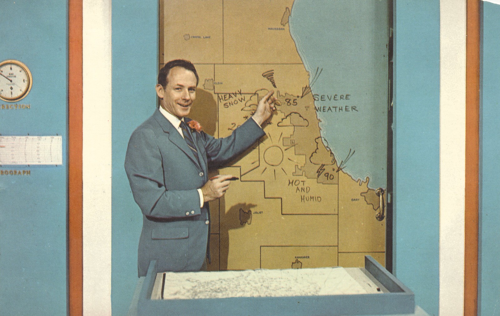
I didn't even notice that but I'm betting the handle is so that he can spin the board around for a different map. Or something. The local news guy here in the 60s used a schoolroom 2-sided chalkboard with a national map on one side and a state map on the other. He spent his 5 minutes hand-writing the temps on the map as he talked about whatever but rarely the temperatures. It was mesmerising to watch; he'd write a few temps then stop his narrative and say Billings 65, Laurel 68, Big Timber 64 and the numbers would be in the right place, unmarked on the map, then he'd start writing numbers again while talking about something else, then stop and read what he wrote.
Yeah, it probably was some kind of pivoting or sliding board. I remember the local weathermen had them when I was a kid - pre-green-screen days. Most of the ones I remember had some sort of marker board with the maps printed on them.
Kind of an odd place to put a map - on a door - with an impossible assortment of temperatures.
I didn't even notice that but I'm betting the handle is so that he can spin the board around for a different map. Or something. The local news guy here in the 60s used a schoolroom 2-sided chalkboard with a national map on one side and a state map on the other. He spent his 5 minutes hand-writing the temps on the map as he talked about whatever but rarely the temperatures. It was mesmerising to watch; he'd write a few temps then stop his narrative and say Billings 65, Laurel 68, Big Timber 64 and the numbers would be in the right place, unmarked on the map, then he'd start writing numbers again while talking about something else, then stop and read what he wrote.
would be interesting to see if you changed your original post to this map if all the reply maps changed as well.
An image in a post is just a link to a file on another computer. In the case of the weather channel map that file (URL http://i.imwx.com/images/maps/current/curtemps_600x405.jpg) is continuously updated so that whenever you reload the forum page your browser will go and get the current version unless it has a cached copy it can use. If you store that image in a different file with a different URL then it will remain static. Changing the URL in the original post would affect only that post. All the posts that replied to the original post would still reference the constantly updated file. All subsequent replies would pick up the new URL.
Yeah, that's odd. I didn't realize when I posted that but the URL is an actively updated image instead of a static one.
It is conceivable that we could have a thread with about a dozen or so WC maps and have a place to get a quick look at the important info. One post for all the maps and just a periodic bump to keep it on the raft.
I don't remember seeing the map being only shades of red (largely deep red), yellow, and orange, but I guess I never looked for that either. The coldest place on the map seems to be around Monterey; the rest looks like a picture of a fire.
What is pretty cool or frustrating about any map you grab from the weather channel, they somehow update themselves.
I don't remember seeing the map being only shades of red (largely deep red), yellow, and orange, but I guess I never looked for that either. The coldest place on the map seems to be around Monterey; the rest looks like a picture of a fire..
Very similar to the comment I made to L after watching last night's weather news: "We're all gonna fry!!"
I don't remember seeing the map being only shades of red (largely deep red), yellow, and orange, but I guess I never looked for that either. The coldest place on the map seems to be around Monterey; the rest looks like a picture of a fire.